Flight · SAPIENCE · July 2026
Flying with visual-inertial odometry
An experimental research flight from SAPIENCE development in July 2026: our first autonomous flight with visual-inertial odometry as the estimator's only source of odometry.
The aircraft and flight
Our team at UAH built the aircraft from off-the-shelf and printed parts. It ran PX4 on a Pixhawk 6X, with a Jetson Orin Nano onboard. I worked on robotics software and took part in flight operations from the ground station, deploying and monitoring the stack.
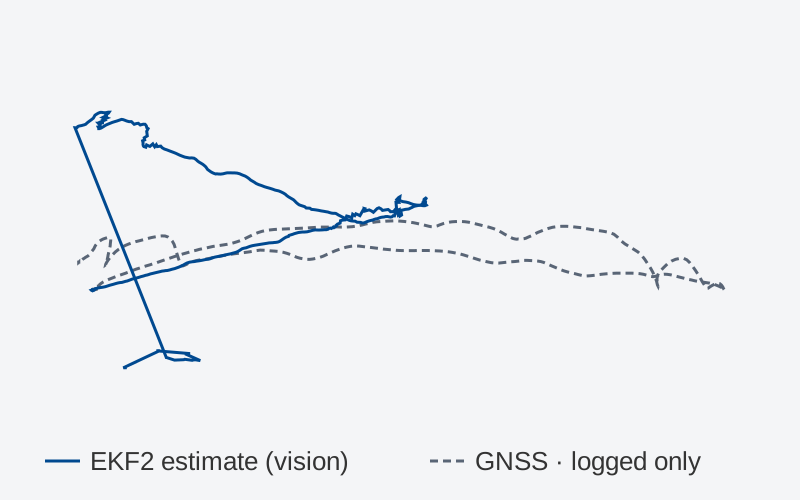
This was an experimental research flight, part of normal development, and our first autonomous flight with VIO as the only source of odometry for PX4's estimator. GPS was logged as ground truth alongside the EKF2 estimate and wasn't fused, so both traces are available to look at.
Reading the traces
Both traces use the same scale. The long straight segment near the end is one jump in the estimate between two log samples. This is one flight log, so it isn’t a general measure of navigation accuracy.
The positions are translated and rotated, so the file shows the track’s shape only. The map in the interactive version is an illustration.
This flight was part of UAH’s work on SAPIENCE. For more on the project itself, see sapienceproject.com.